091-5758564, 081-6679233 ,02 7035192
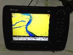
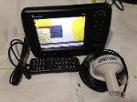
GPS ดาวเทียม SAMYUNG N80 จอ8" จอสี LCD เมนูภาษาไทย ลดราคาพิเศษจาก45000เหลือ42000บาท
 เพิ่มเมื่อ: 2018-05-15 11:55:30.0
 แก้ไขล่าสุด: 2021-06-16 13:21:17.0
 เบอร์โทรติดต่อ: 091-5758564, 081-6679233 ,02 7035192
  อีเมลล์: ChotigaLim@gmail.com LINE ID.nisakornn1
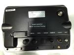
GPS ดาวเทียม SAMYUNG N80 จอ8" จอสี LCD
ดาวเทียม SAMYUNG N80A/NF80A
USER MANUAL
Safety instructions
This device’s electronic chart system (ECS) is developed for the navigational aid only and chart itself does not obtain any approvals; has not been certified from the government authorities. lf operator needs safe navigation then must use an official chart that has been approved by government agencies;
Also operator is fully responsible for using this device.
Please read through this manual before the first operation. Lf you have any
Question, please contact the customer service or your local dealer or distributor
Extensive exposure to heat may result in damage to the chart plotter.
Connection to the power source with reversed polarity will damage the chart plotter severely. This damage is not covered by the warranty.
Do not disassembly. The chart plotter contains dangerous high voltage circuits which only experienced technicians must handle
Exposure of the display to UA rays may shorten the life of the liquid crystals used in you plotter. The limitation is due to the current technology of the LCD display.
Avoid overheating which may cause loss of contrast and, in extreme case, a darkening of the screen. Problems which occur from overheating are reversible when temperature decreases.
Screen Cleaning Precautions
Cleaning your chart plotter screen is a very important and must be done carefully. The following is the cleaning procedure.
You use a tissue or lens tissue and a cleaning spray containing Isopropanol (a normal spray cleaner sold for PC screens. Fold the tissue or lens tissue into a triangular shape, moisten the tip and use the index finger behind a corner to move the tissue across the surface, in overlapping side to side strokes. If the tissue is too wet, a noticeable wet film will be left in its path and you will need to repeat the process. If too dry, the tissue won’t glide easily, and may damage the surface.)
Introduction
The chart plotter is a precision-crafted GPS chart Plotter with high-performance receiver .NAVTEX
for the Global Positioning System .VIDEO
constellation of satellites, providing precise .AIS RECEIVER
location data with a host of navigation .DSC VHF RADIO
features. Some functions require optional .Transducer & sensors
units and sensors, installed on your boat. The chart plotter can be connected to external devices and display information. Following are the examples. Autopilot
Specification
N80A
|
GENERAL |
||
|
Category |
Detail |
|
|
Size |
201mm(H)x 293mm(W)x 92mm(D) |
|
|
Display |
8 inch, TFT color, 800x600 pixel |
|
|
Supply Voltage |
11 ̴ 36V DC |
|
|
Supply Current |
24V (Equipment Only) Maximum LCD Brightness 700mA Maximum LCD Brightness 330mA |
24V(Equipment Only) Maximum LCD Brightness 800mA Maximum LCD Brightness 560mA |
|
Alarm Output |
Sound alarm equipment, 30V DC, maximum 200mA |
|
|
Temperature |
10 ̊C ̴ + 50 ̊C |
|
|
ALARMS |
||
|
User setting: Alarm alert, anchor alert, XTE, danger alert, low battery, AIS dangerous vessel alert, AIS approach alert. |
||
|
GPS NAVIGATION |
||
|
Chart card |
SD Card |
|
|
User card |
SD Card |
|
|
Waypoints |
Up to 30,000 |
|
|
Routes |
100 routes (1 route – 100 points) |
|
|
Tracks |
10 tracks setting (1 track – 30000 points) |
|
|
Chart datum s |
216 chart datum s |
|
|
Chart scale |
Approximately 0.2 ̴ 500nm (1/2,500 ̴ 1/37,500,000) |
|
|
COMMUNICATIONS |
||
|
NMEA |
NMEA 0183 Speed :4800, 9600, 38400, NMEA 2000 |
|
|
NMEA 0183 input |
DBK, DBS, DBT, DPT, GGA, GLL, GNS, GGA, GSV, HDG, HDT, MDA, MTA, MTW |
|
|
|
||
|
|
MWD, MWV, RMC, RPM, VHW, VTG, VWT, ZDA |
|
|
NMEA 2000 input |
System date and time (PGN126992), Vessel Heading (PGN127250),Engine parameters/Rapid Update (PGN127488),Engine parameters/Dynamic (PGN127489),Trip Parameters/ Engine (PGN127497),Engine Parameters/Static (PGN127498), Fluid level (PGN127505),Water Speed (PNG128259),Water depth (PNG128267),Position/Rapid Update (PNG129025),COG & SOG/Rapid Update (PNG129026), GNSS Position Date (PNG129029), GNSS DOPs(PNG129539),GNSS Sat s in View(PNG129540),Wind Date(PGN130306),Environmental Parameter-Water Temp(PNG130310),Environmental Parameter (PNG130311) |
|
|
NMEA 0183 output |
APA, APB, BWR, GGA, GLL, GSA, GSV, RMB, RWB, RMC, VTG, XTE, DBT, DPT, MTW, VHW,XDR |
|
|
NMEA 2000 output |
+++ Water Speed(128259), Water depth (128267), XTE(129283), NAV. Date(129284), NAV. Date(129285), COG & SOG(129026), GNSS position(129029), Water temp.(130310) |
|
|
FISHFINDER * measurable water level may vary due to the weather condition. |
||
|
Depth * Possible depth |
0m ̴ 600m (600W) /0m ̴ 1000m (1KW) |
|
|
Output of transducer |
Power : it is variable and maximum 1KW RMS Can use 2 frequency (50 kHz, 500 kHz) |
|
|
Temperature |
Range : 0 ̊ ̴ 37.7 ̊C (32 ̊ F ̴ 99.9 ̊F) |
|
NF80A
|
GENERAL |
||
|
Category |
Detail |
|
|
Size |
201 mm(H)x 293mm (W)x 92mm(D) |
|
|
Display |
8 inch, TFT color, 800 x 600 pixel |
|
|
Supply Voltage |
11 ̴ 36V D C |
|
|
Supply Current |
24V(Equipment Only) Maximum LCD Brightness 700mA Maximum LCD Brightness 330mA |
24V (Equipment Only) Maximum LCD Brightness 1.73A Maximum LCD Brightness 1.32A |
|
Alarm Output |
Sound alarm equipment, 30V DC, maximum 200mA |
|
|
Temperature |
10 ̊C+50 ̊C |
|
|
ALARMS |
||
|
User setting : Alarm alert, anchor alert, XTE, danger alert, low battery, AIS dangerous vessel alert, AIS approach alert. |
||
|
GPS NAVIGATION |
||
|
Chart card |
SD card |
|
|
User card |
SD card |
|
|
Waypoints |
Up to 30,000 |
|
|
Routes |
100 routes (1route – 100points) |
|
|
Tracks |
10 tracks setting (1track -30,000 points) |
|
|
Chart datum s |
216 chart datum s |
|
|
Chart scale |
Approximately 0.2 ̴ 500nm (1/2,500 ̴ 1/37,500,000 ) |
|
|
COMMUNICATIONS |
||
|
NMEA input |
NMEA 0183 Speed : 4800, 9600, 38,400, NMEA 2000 |
|
|
NMEA 0183 input |
DBK, DBS, DBT, DPT, GGA, GLL, GNS, GGA, GSV, HDG, HDT, MDA, MTA,MTW, |
|
|
|
MWD, MWV, RMC, RPM, VHW, VTG, VWT, ZDA |
|
|
NMEA 2000 input |
System date and time(PGN126992), Vessel Heading (PGN12750), Engine Parameters/Rapid Update(PGN127488),Engine parameter/Dynamic (PGN127489), Trip parameters/Engine (PGN127497),Engine parameters/Static(PGN127498),Fluid level(PNG127505), Water S[peed (PGN128259)Water/depth(PGN128267),Position/Rapid Update(PGN129025), COG & SOG/Rapid Update(PGN129026),GNSS Position Data(PGN129029), GNSS DOPs(PGN129539), GNSS Sats in View (PGN129540), Wind Data(PGN130306),Environmental Parameter- Water temp (PGN130310), Environmental Parameter(PGN130311) |
|
|
NMEA 0183 output |
APA, APB, BWR, GGA, GLL, GSA, GSV, RMB, RMC, VTG, XTE, DBT, DPT, MTW, VHW, XDR |
|
|
NMEA 2000 output |
+++ Water Speed (128259), Water depth(128267),XTE(129283) NAV. Data(129284), NAV. Data(129285), COG & SOG(129026) GNSS position(129029), Water temp.(130310) |
|
|
FISHFINDER * measurable water level may vary due to the weather condition. |
||
|
Depth * Possible depth |
0m ̴ 60m(600W) / 0m ̴ 1000m (1KW) |
|
|
Output of transducer |
Power : it to variable and maximum 1KW RMS Can use 2 frequency (50 kHz 200 kHz) |
|
|
Temperature |
Range : 0 ̊ ̴ 37.7 ̊C (32 ̊F ̴ 99.9 ̊F) |
|
NF 80A -1KW
|
General |
||
|
Category |
Detail |
|
|
Size |
200mm (H)x293mm (W)x92mm(D) |
|
|
Display |
8 inch, TFT color, 800x600 pixel |
|
|
Supply Voltage |
11 ̴ 36V V DC |
|
|
Supply current |
24V (Equipment only) |
24V (Equipment only) |
|
|
Maximum LCD Brightness 850mA |
Maximum LCD Brightness 1.57A |
|
|
Maximum LCD Brightness 470mA |
Maximum LCD Brightness 1.16A |
|
Alarm output |
Sound alarm equipment, 30V DC ,maximum 200mA |
|
|
Temperature |
- 10 ̊C ̴ + 50 ̊C |
|
|
ALARM |
|
|
|
Use setting : Alarm alert , anchor alert, XTE, danger alert, low battery, AIS dangerous vessel alert, AIS approach alert. |
||
|
GPS NAVIGATION |
||
|
Chart card |
SD Card |
|
|
User card |
SD Card |
|
|
waypoints |
Up to 30,000 |
|
|
Routes |
100 routes (1 routes – 100 points) |
|
|
Tracks |
100 Tracks (1 Track – 30,000 points) |
|
|
Chart datum s |
216 chart datum s |
|
|
Chart scale |
Approximately 0.2 ̴ 500mm (1/2,500 ̴ 1/37,500,000) |
|
|
COMMUNICATIONS |
||
|
NMEA |
NMEA 0183 Speed : 4800, 9600, 38400 , NMEA 2000 |
|
|
NMEA 0183 Input |
DBK, DBS, DBT, DPT, GGA, GLL, GNS, GGA, GSV, HDG, HDT, MDA, MTA, MTW, MWD, MWV, RMC, RPM, VHW, VTG, VWT, ZDA |
|
|
NMEA 2000 Input |
System date and time(PGN126992), Vessel Heading(PGN127250), Engine parameters/Rapid Update(PGN127488),Engine parameters/Dynamic (PGN127489),Trip parameters/Engine(PGN127497), Engine parameters/Static(PGN127498), Fluid level(PGN127505),Water Speed(PGN128259), Water depth(PGN128267), Position/Rapid Update(PGN129025), COG & SOG/Rapid Update(PGN129026), GNSS Position Data()PGN129029 GNSS DOPs(PGN129539) GNSS Sat s in View(PGN129540), Wind Date(PGN130306), Environmental Parameters-Water temp(PGN130310), Environmental Parameter(PGN130311) |
|
|
NMWA 0183 Output |
APA, APB, BWR, GGA, GLL, GSA, GSV, RMB, RMC, VTG, XTE, DBT, DPT, MTW, VHW, XDR |
|
|
NMEA 2000 Output |
+++ Water Speed (128259),Water depth(128267), XTE(129283),NAV. Data(129284), NAV. Data(129285), COG & SOG(129026), GNSS position(129029), Water temp.(130310) |
|
|




 สินค้าที่เกี่ยวข้อง